![](/images/other/stat-length.png)
![Tour Wandern Longny les Villages - [Itinéraire] Les manoirs - Photo](https://media.geolcdn.com/t/1900/400/ext.pjpeg?maxdim=2&url=https%3A%2F%2Fstatic1.geolcdn.com%2Fsiteimages%2Fupload%2Ffiles%2F1553511878bg_sport_marche.png)
[Itinéraire] Les manoirs
ODDAD78
Benutzer
![Länge](/images/other/stat-length.png)
![Maximale Höhe](https://static1.geolcdn.com/siteimages/upload/files/1508320355ic_sort_altitude_max_24dp.png)
![Positive Höhendifferenz](https://static1.geolcdn.com/siteimages/upload/files/1508320355ic_sort_den_pos_24dp.png)
![Km-Effort](/images/other/stat-length.png)
![Min. Höhe](https://static1.geolcdn.com/siteimages/upload/files/1508320355ic_sort_altitude_min_24dp.png)
![Negative Höhendifferenz](https://static1.geolcdn.com/siteimages/upload/files/1508320355ic_sort_den_neg_24dp.png)
![Boucle](https://static1.geolcdn.com/siteimages/upload/files/16400158638029165_repeat_loop_refresh_sync_direction_icon.png)
![Wandern](https://static1.geolcdn.com/sitytour/trail-icons/101.png)
1h18
Schwierigkeit : Einfach
![Scannen Sie diesen QR-Code, um die Tour in der SityTrail-Anwendung zu öffnen](https://capi.geolives.com/qq0zvz2zws4bq2lad0pu/sitytour/trails/3943737/qr.png?size=200)
Kostenlosegpshiking-Anwendung
Über SityTrail
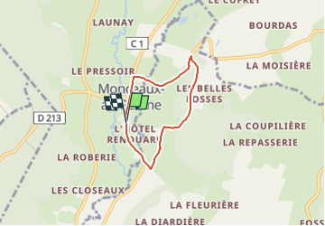
Tour Wandern von 4,4 km verfügbar auf Normandie, Orne, Longny les Villages. Diese Tour wird von ODDAD78 vorgeschlagen.
Beschreibung
Une courte randonnée idéale pour les amateurs de patrimoine bâti, ce circuit vous amène à remonter le temps en allant à la découverte de superbes bâtisses du Perche Ornais.
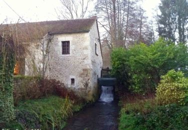
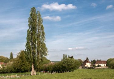
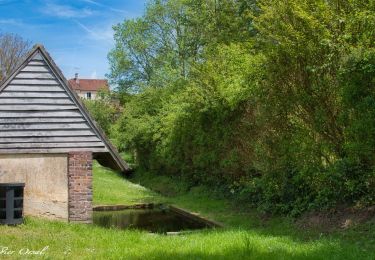
Au départ du charmant village de Manceaux-au-Perche, cette randonée constitue une agréable balade peremttant à la fois de flâner en découvrant la campagne environnante, et de profiter du patrimoine local en contemplant des bâtisses anciennes tel que le Manoir du Pontgirad, le Manoir du Gué ou encore l’Hôtel Renouard.
Pas à pas (Rando-Perche)
Départ : Monceaux-au-Perche Arrivée : Monceaux-au-Perche Balisage : PR
Communes : 1. Monceaux-au-Perche 2. Boissy-Maugis
Se diriger vers l'Église et traverser le bourg. Mariette de Notre- Dame de la Clavière, élevée en 1989. L'Hôtel Mercier.
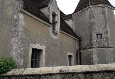
1. Quitter la D 111 pour suivre la D 213, à droite. Manoir du Gué (sur droite) : robuste construction du XVI° siècle, il se signale par sa tour octogonale flanquant le logis et ses lucarnes passantes à meneaux. Franchir la Jambée et continuer sur la route (PRUDENCE). Ignorer le chemin de la Rose sur votre droite, puis tournez au prochain chemin sur la droite en direction des Belles Fosses.
2. À la première intersection, poursuivre tout droit (en laissant le chemin des Belles Fosses partir sur votre gauche). Longer le bois et redescendre le coteau. Après un coude, emprunter à gauche le chemin de la Martinière-Mirabon qui va rejoindre la VC 8.
3. Prendre à droite pour récupérer la D 111.
Ort
Kommentare
Touren in der Umgebung
![Tour Wandern Longny les Villages - Monceaux au Perche (Boucle) - Photo](https://media.geolcdn.com/t/375/260/ext.jpg?maxdim=2&url=https%3A%2F%2Fstatic1.geolcdn.com%2Fsiteimages%2Fupload%2Ffiles%2F1553511878bg_sport_marche.png)
![Wandern Wandern](https://static1.geolcdn.com/sitytour/trail-icons/101.png)
Wandern
![](/images/other/stat-length.png)
![](https://static1.geolcdn.com/siteimages/upload/files/16400158638029165_repeat_loop_refresh_sync_direction_icon.png)
![Tour Wandern Bizou - [Itinéraire] Les sables du Perche - Photo](https://media.geolcdn.com/t/375/260/6b586e88-fad3-40df-be07-9b2a61186b9b.jpeg&format=jpg&maxdim=2)
![Wandern Wandern](https://static1.geolcdn.com/sitytour/trail-icons/101.png)
Wandern
![](/images/other/stat-length.png)
![](https://static1.geolcdn.com/siteimages/upload/files/16400158638029165_repeat_loop_refresh_sync_direction_icon.png)
![Tour Zu Fuß Longny les Villages - Attelage - Forêt et Panoramas - forêt de Réno-Valdieu - Photo](https://media.geolcdn.com/t/375/260/db99a0ed-9413-4500-8368-446623bccd86.jpeg&format=jpg&maxdim=2)
![Zu Fuß Zu Fuß](https://static1.geolcdn.com/sitytour/trail-icons/100.png)
Zu Fuß
![](/images/other/stat-length.png)
![](https://static1.geolcdn.com/siteimages/upload/files/16400158638029165_repeat_loop_refresh_sync_direction_icon.png)
![Tour Wandern La Chapelle-Montligeon - [Itinéraire] Le Mont Ligeon - Photo](https://media.geolcdn.com/t/375/260/ce92da88-fb92-411f-965d-5e4e270d0f79.jpeg&format=jpg&maxdim=2)
![Wandern Wandern](https://static1.geolcdn.com/sitytour/trail-icons/101.png)
Wandern
![](/images/other/stat-length.png)
![](https://static1.geolcdn.com/siteimages/upload/files/16400158638029165_repeat_loop_refresh_sync_direction_icon.png)
![Tour Wandern Cour-Maugis sur Huisne - 12102996-Maison Maugis 22.37 - Photo](https://media.geolcdn.com/t/375/260/ext.jpg?maxdim=2&url=https%3A%2F%2Fstatic1.geolcdn.com%2Fsiteimages%2Fupload%2Ffiles%2F1553511878bg_sport_marche.png)
![Wandern Wandern](https://static1.geolcdn.com/sitytour/trail-icons/101.png)
Wandern
![](/images/other/stat-length.png)
![](https://static1.geolcdn.com/siteimages/upload/files/16400158638029165_repeat_loop_refresh_sync_direction_icon.png)
![Tour Wandern La Chapelle-Montligeon - La Chapelle-Montligeon - Longny-au-Perche via Bizou 16 km - Photo](https://media.geolcdn.com/t/375/260/5e36f740-ecc7-4760-b425-4f15cc356d54.jpg&format=jpg&maxdim=2)
![Wandern Wandern](https://static1.geolcdn.com/sitytour/trail-icons/101.png)
Wandern
![](/images/other/stat-length.png)
![](https://static1.geolcdn.com/siteimages/upload/files/16400158638029165_repeat_loop_refresh_sync_direction_icon.png)
![Tour Wandern La Chapelle-Montligeon - La Chapelle-Montligeon - Moutiers-au-Perche via Bizou 20 km - Photo](https://media.geolcdn.com/t/375/260/4094c967-a97a-44d3-924e-010e9be9049f.jpg&format=jpg&maxdim=2)
![Wandern Wandern](https://static1.geolcdn.com/sitytour/trail-icons/101.png)
Wandern
![](/images/other/stat-length.png)
![](https://static1.geolcdn.com/siteimages/upload/files/16400158638029165_repeat_loop_refresh_sync_direction_icon.png)
![Tour Wandern La Chapelle-Montligeon - La Chapelle-Montligeon - Le Mage via Bizou 18 km - Photo](https://media.geolcdn.com/t/375/260/2514d07f-ce42-4914-ba12-eb561f06fea2.jpg&format=jpg&maxdim=2)
![Wandern Wandern](https://static1.geolcdn.com/sitytour/trail-icons/101.png)
Wandern
![](/images/other/stat-length.png)
![](https://static1.geolcdn.com/siteimages/upload/files/16400158638029165_repeat_loop_refresh_sync_direction_icon.png)
![Tour Wandern Longny les Villages - Monceaux et le Manoir - Photo](https://media.geolcdn.com/t/375/260/2c895f3a-5924-449a-a873-4ad274746411.jpg&format=jpg&maxdim=2)
![Wandern Wandern](https://static1.geolcdn.com/sitytour/trail-icons/101.png)
Wandern
![](/images/other/stat-length.png)
![](https://static1.geolcdn.com/siteimages/upload/files/16400158638029165_repeat_loop_refresh_sync_direction_icon.png)